In a nutshell, the trip was fantastic: Warm and sunny weather most of the way, a great group as usual (newcomer Linda and 11-year-old Colin were stellar additions), and a route that had a little bit of everything.
Sunday: Hermit trailhead to Boucher Creek. We had forgotten just how nasty a descent the Boucher is; add some ice and snow to the shady recesses of the trail, and things get really interesting in places. The worst part is in Travertine Canyon, where the trail seems to go almost straight down through the Supai Group. Here, the term “trail” is a reach; what it really is is one boulder scramble after another — not much fun on a steep pitch with a 55-pound pack on one’s back. (A photo from 1979 shows a section of the trail.) Once we finally reach camp, there are a lot of frayed nerves and sore extremities. Three Advil before bedtime will be a must — especially for Loretta, who is all scratched up from doing a faceplant into a bush on the trail. A chilly, clear night. Sometime before dawn, some of us are jolted awake by the boom of a distant earthquake.
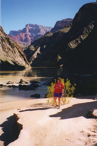
Loretta at Boucher beach (Photo by Marlene)
Monday: Boucher Creek to Boucher Rapids. An easy hike of less than 2 miles down the creekbed to the beach. The river’s roar is loud, constant and awesome. We set up camp and then just take it easy. Not a cloud anywhere: in the sun you roast, but in the shade it’s only 60 degrees. We all still must be tuckered from Sunday’s hike, because after dinner, Stan goes to bed at 7 and the rest of us last only until 8. Around midnight, there’s another earthquake, only this time we can feel the ground move.
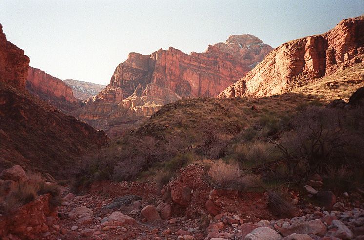
Morning in lower Boucher
On the Tonto entering Slate
Tuesday: Boucher Rapids to Slate Canyon. A mouse has broken into Marlene’s food during the night. For a while, tonight’s dinner (salmon and pasta) seems in jeopardy, but an inspection by Stan determines everything is reasonably safe to eat. Then off we go to Slate. It is about a four-hour trek; most of us arrive between noon and 1. We set up camp and eat lunch. It’s definitely warmer than yesterday. After a while, another group arrives, but instead of camping at a perfectly good site several hundred yards away, they claim part of our area as their own. No amount of diplomacy will get them to budge. It figures that the biggest annoyance of the trip is provided by humans and not by any of the nasty stuff that mother nature can throw at you. Dinner time finally rolls around and the salmon is superb (and weeks later there are no signs of rabies or hantavirus in any of us).
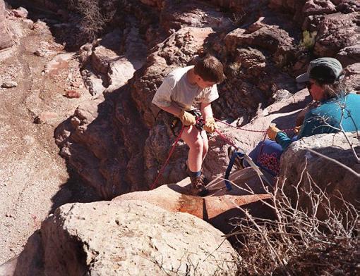
Colin goes over the edge
Wednesday: Stay at Slate Canyon. In the morning we do some rappelling at the big pouroff just downhill from where the Tonto Trail crosses the main Slate drainage. After lunch, Loretta and Linda explore Slate Canyon upstream from camp, and Colin, Joe, Rhodana and Marlene go downstream. At a 10-foot pouroff about an hour downcanyon, Marlene’s brand-new camera tumbles out of her day pack and into the water below. Joe slides down the pouroff and rescues the submerged Pentax but then cannot get back up. (This is the same spot where a log provided a way up during our 1987 trip.) A bit of technical climbing only gets him into more trouble — there he is, clinging to a rock face about 6 feet off the ground, unable to proceed or to get back down. He could jump down, but he'd risk breaking or spraining an ankle. If he could just reach a toehold about 5 feet to his right, he’d be home free. But it’s too much of a stretch; he’d almost certainly take a backwards fall. A couple of tense minutes pass. Finally, Rhodana takes action. She inches out across the rock face almost to the toehold, then offers an outstretched hand. Joe grabs it and makes the big step to the toehold. The rest is easy. Later, this makes for good after-dinner storytelling. Under a moon just one night short of being full, the canyon treefrogs also are talking it up, in their nonstop, goat-like croaks.
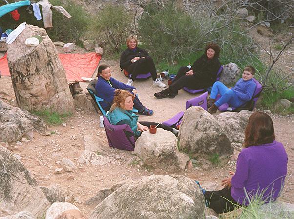
Social hour at Boucher Creek
Thursday: Slate Canyon to Boucher Creek. Now it is time to return to Boucher Creek, the same place we stayed the first night. In two or three hours we are there, and we keep busy doing the usual things — setting up camp, pumping water through the Katadyn filter, taking a sponge bath with a pot or two of creek water. The only problem on this tranquil afternoon is with the resident flies, whose only purpose in life seems to be landing on the faces of otherwise contented humans. A few wispy clouds have moved in during the last 24 hours, but they do not look like trouble. The tents stay in the packs. With any luck, we will get through this week without a drop of rain.
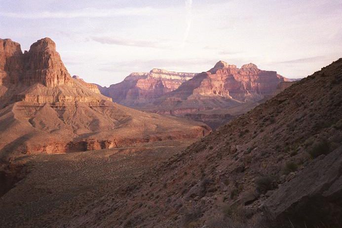
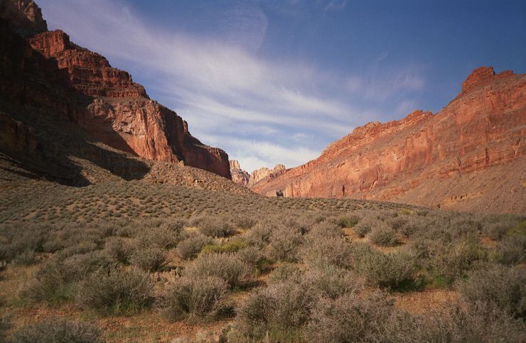
Morning light
in upper Boucher Canyon
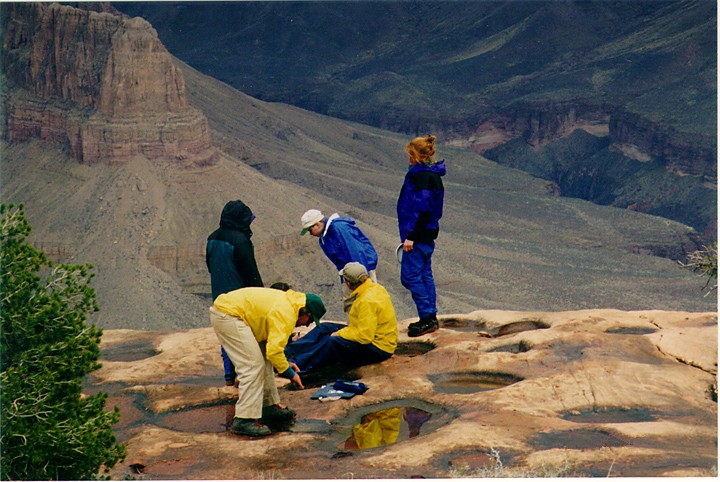
Collecting water above Columbus Point (Photo by Marlene)
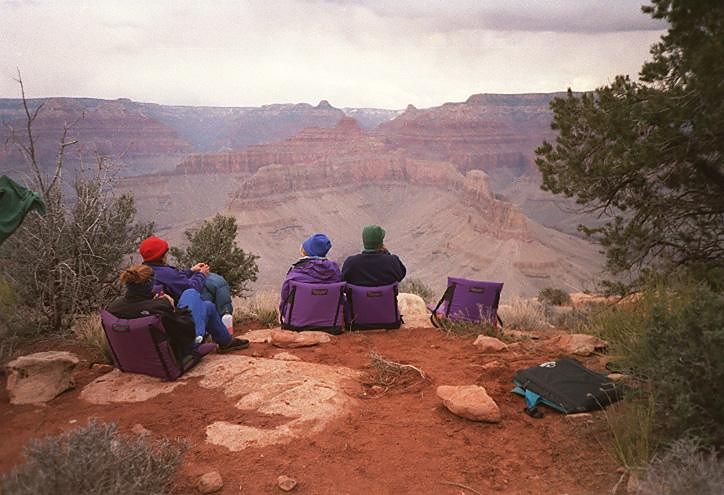
Front-row seats at Columbus Point “IMAX”
Friday: Boucher Rapids to Yuma/Columbus Point. Overnight, heavier clouds have moved in. Today we must climb the stretches of the Boucher Trail that were so bad on the way down. In years past we have lugged several gallons of extra water to the dry camp at the point, but this time we are gambling that the rain pockets we saw up there Sunday will not have dried up by now. The 2,500-foot climb is exhausting, but somehow we cover this stretch of trail in less time than we did on the way down. By 1 p.m. or so, everyone has made it to the point, and that’s about when the storm suddenly hits: rain and sleet driven by gusty winds. We scramble to set up tarps and tents. One tent, not yet staked down, takes off like a tumbleweed straight toward a 30-foot cliff, but it is grabbed in the nick of time. After maybe a half hour, the rain stops and we can take some time to improve our shelters and air out whatever got soaked. Before long it is time to eat what is the week’s worst dish by far (Natural High brand Chili Mac, the only prepackaged backpacking dinner of the trip). Afterward, we sit around and listen to it digest as we gaze out at the panaroma that makes this mile-high point one of our favorite spots (here is a shot from 1992 when the skies were clear). Nobody feels like staying up past dark, and not long after we are bedded down, the rain and the winds return.
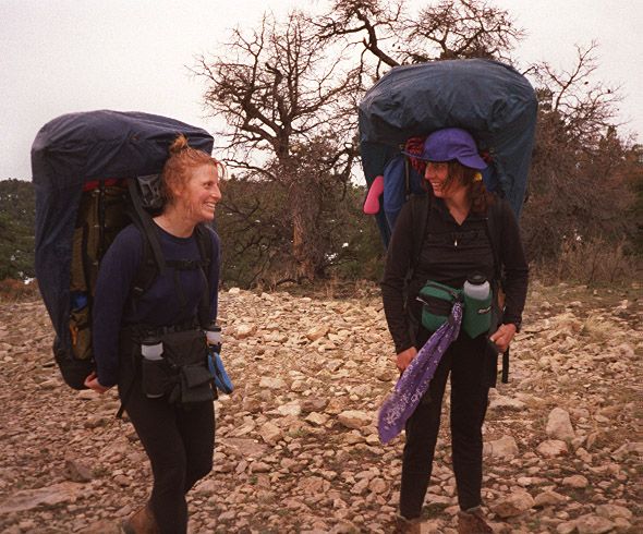
Rho and Marlene reach the top
Saturday: Yuma/Columbus Point to Hermit trailhead. Rain has been coming down on and off all night, and as we break camp it is still raining lightly. Somewhat grudgingly, we hit the trail, and in a few minutes the rain stops. Off with our rain gear. It’s cloudy and cool — better this than hot sun when there’s tough climbing to do. The downside is the red mud caking up on our boots; the extra weight is the last thing we need for the final ascent. The clouds are dipping below the rim in places as we wind our way along the red Hermit shale on the west and south sides of Hermit Canyon. Soon we intersect Hermit Trail. This is the homestretch, the 1,500-foot ascent through the canyon’s three whitish uppermost layers: Coconino sandstone, Toroweap formation and Kaibab formation. Up, up, up goes the trail. This part is never easy. Could the pack actully be getting heavier? Soon those low-riding clouds envelop us. First a fog, then a mist, then a light rain. A rest break would be just the thing right now, but we must keep going, taking smaller and smaller steps if need be, but always moving so as to ward off the chill. At long last, the trail levels off amid the piñon pines, and there is our car. We are out! It is starting to snow a little. We throw our dripping packs into the back of the vehicle, climb in, turn on the ignition and crank up the heater. Time for our great reward. There in the car are a can of beer and a jar of jalapeno-stuffed olives. We pop them both open and pass them around. This is the life. We’ll definitely be back.
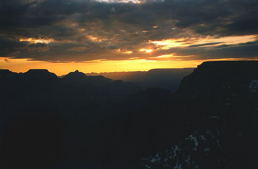
South Rim sunrise (Photo by Marlene)
| All text & photos © 1995-2026 by Joe Hudson & the Grand Canyon Junkies, except as noted. |