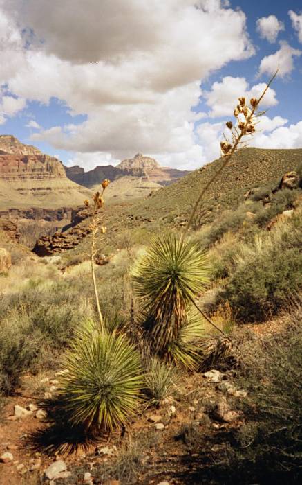
DAY ONE: It’s just three miles from the South Rim to our first night’s camp, on Horseshoe Mesa, some 3,000 vertical feet down. Still, the hike down takes us at least two hours, thanks to icy stretches on the upper Grandview Trail. Instep crampons make the going much safer. Joe trails most of the group by an hour after turning back to fetch his camera, which he left in his suitcase (this is not the first time he has done this!). Down on the red-dirt mesa, the weather is perfect — sunny, mid-60s. Junipers and piñons provide shade and places to hang things, and the vistas are fabulous. But we aren’t used to camping among so many other people. Every few minutes, it seems, someone is passing through. The mesa is a high-use area, and we are glad we will be here only one night.
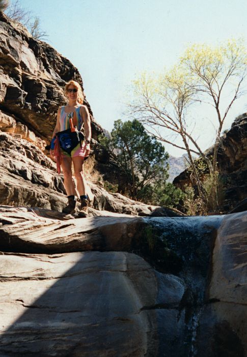
There is plenty of time to relax, but one chore does need to be done before dinnertime: fetching water from Miner’s Spring below the mesa. Rhodana, Marlene and Loretta volunteer, and off they go in their shorts and sandals, expecting this to be quick and easy. Sure enough, 20 minutes later they return — but without water, and more than a little annoyed. They had to turn back; it seems Stan and Joe failed to advise them on the degree of difficulty of this steep trail. The three women change into hiking boots and take off again. Ninety minutes later, they are back with the water, and it is clear that Stan and Joe owe them one. In retrospect, hauling extra water down from the rim might have been easier.
After dinner is consumed, the conversation lasts well after dark, as always. The night air is warm for this time of year — around 50. Stars fill the moonless sky. Everything is right, except for the occasional voices and flickering of flashlights from other campsites to remind us we do not have this place to ourselves. The hour gets later, and the talk dwindles as one by one we call it a night. After most of us are snug in our bags, a disturbing sound bellows forth from the darkness. This is not a coyote or a mountain lion or some stray donkey. No, it is unmistakable: Someone on the mesa is throwing up.
In Cottonwood Canyon
DAY TWO: We rise, eat breakfast (instant oatmeal or breakfast bars), break camp and hit the trail for Cottonwood Canyon. This should be easy: Just a little over an hour of hiking, and we’ll have the rest of the day free. Joe and Loretta start off first and quickly descend the Redwall on the mesa’s west side. Soon they are down in the Cottonwood Canyon drainage, and they follow the trail along the streambed down to where the Tonto Trail intersects. This is camp. They shed their gear, guzzle some water and wait for the others.
About 40 minutes later, Stan arrives. “So where’s everyone else?” he asks. He was the last to leave the mesa campsite. Barb, Marlene and Rhodana should have been here long ago. Stan climbs to a better vantage point and scans the landscape for any sign of the missing trio. Nothing. The watching and waiting goes on for more than an hour until, finally, the three women march in, hot and tired. They won’t say much at first, but Barb finally admits she took a wrong turn during the first few hundred yards and led the group onto the wrong trail. They went far out along the western rim of Horseshoe Mesa instead of dropping immediately into Cottonwood Canyon, and then they had to backtrack. The scheduled “easy” hike turned into a nearly three-hour grind. Rhodana, always finding the silver lining, says she’s glad she got to see more of the canyon than she otherwise would have. The two others don’t exactly share her glee.
Cottonwood Creek is running lower than usual. In most spots it’s just a few feet wide and a few inches deep. On the west side of the creek are several stretches of almost-level ground next to a wall of brown Tapeats sandstone. This is where most of us set up camp. Overhangs in the wall offer shelter from a rainstorm, but that shouldn’t be a factor — the clear, warm weather looks as if it will last. Most of us decide not to bother with putting up tents or tarps. The afternoon is spent lounging, washing up, and doing some leisurely exploring of Cottonwood Canyon downstream from camp. Cottonwood is said to be hikeable all the way down to the river, but too little of the day is left to try that.
About an hour before dinnertime, a young man — tan and lean, with long, wavy brown hair — passes through camp. He has tried hiking down to the river but has run out of time and is now returning to his campsite about a mile upstream from us. He tells us his name is Richard, and he is from Australia. He is a biologist of some sort, and lately he has been researching the secretions of a particular sea creature. We invite him to sit down, and he and Stan start talking about mitochondria, Australian beers and what not. The females in our group are obviously intrigued by the stranger’s accent, his intelligence and his eyes. After a 20-minute visit, he says he really must get back to camp, and off he goes. In the upset of the week, the women do not follow.
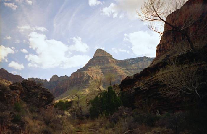
View from Cottonwood camp
DAY THREE: After breakfast, everyone is packed and just about ready to take off for the next destination: Grapevine Canyon. But what’s this? Here comes Stan, our de facto ringleader, moving faster than we’ve seen him since before his bad hip started acting up a couple of years ago. He’s waving our backcountry permit. “Don’t go,” he says. “I screwed up.” Sure enough, we are not supposed to hike to Grapevine today after all. We’re scheduled for another night here in Cottonwood. Grapevine, one of our favorite spots, was supposed to be where we’d spend our only rest day. But now that won’t be possible. Cottonwood will have to do.
Our itinerary doesn’t include the customary night or two along the Colorado River. This is Rhodana’s first time in the canyon, and it is now obvious that a side hike today will be her only chance to get all the way down to the bottom. She, Marlene and Joe pack up some food and water, and off they go — but not down Cottonwood Canyon. The Australian’s account of his trek down Cottonwood persuaded them to try an alternative route. They climb out of the Cottonwood drainage and take the Tonto Trail west. After nearly an hour, they finally see the cairns that mark a route down to the river, more than a thousand vertical feet below. The terrain looks impossibly steep, but they have faith: Where there’s a cairn, there’s a way. Usually.
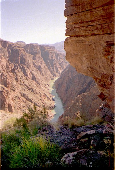
The descent to the river
The trail and the footing are good for the first 20 minutes of descent. Then the fun begins. The trail takes a short, unexpected climb over a saddle and then drops down a steep slope of loose rock. Rhodana, Marlene and Joe cautiously make their way down the talus as the trail becomes indistinct and then nonexistent. Then it’s another short climb, and another steep descent — this one much longer than the first. This slope, too, is primarily talus, but there are some stretches where the trail is distinct and the footing solid. Still, this is stressful hiking, being constantly on guard against taking a spill or dislodging rocks onto the person below. As the threesome descends, the river comes into full view, and it becomes apparent that this slope will lead all the way down to the water. A few more minutes of careful descent, and the hikers are all the way down — two hours after leaving camp.
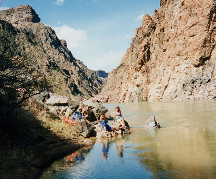
At the river
Not much beach is here among the boulders. What little sand there is, most of it is damp and in the shade — and Marlene and Rhodana have not traveled all this way to sit in the shade. They find a couple of smooth, flat-topped boulders in the sun a few feet out in the river, and that is where they have lunch. Joe opts for some nearby shade. The water speeds past with scarcely a ripple. Only one thing could improve this scene: rafters coming to shore to share some of their beer. But that particular fantasy will have to wait at least another year. On this day, this stretch of the Colorado River is empty.
The climb back up to the Tonto is steep and exhausting. Yet the return to camp takes a half-hour less than the hike to the river did. Ascending the talus somehow seems much safer than going down it, and far less caution is exercised.
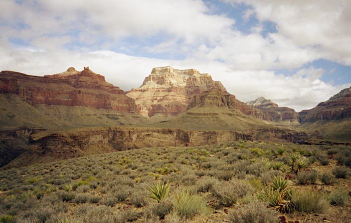
On the Tonto east of Grapevine
DAY FOUR: This is the day we really do hike over to Grapevine. But first we must dry out some of our gear. A cold front surprised us during the night, dumping rain and sending us scurrying for shelter. (The overhangs in the Tapeats wall came in handy after all.) It could have been worse: In the higher elevations, from the Supai Group on up to the rim, fresh snow has coated the canyon.
Grapevine is the next canyon over, and in a little over two hours we are there. The creek bed at this spot is one endless stretch of smooth rock. Downstream are enticing pools and dropoffs. But any exploring will have to wait. The sky is gray, the air is cool, and it could rain at any moment. We must set up our shelters.
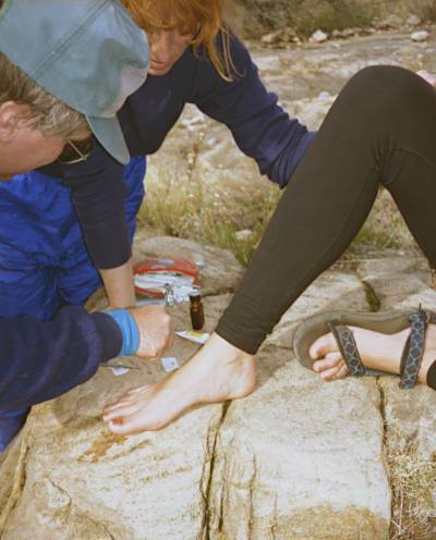
Toenail surgery
This is Marlene’s sixth trip into the canyon, but it’s her first without her old black Army boots. She has retired them in favor of a pricey pair whose brand name shall go unmentioned. She started having her doubts on the first day of this trip, when some leather ripped. Now, another problem: The big toe on her right foot is throbbing unbearably. She has Stan take a look, and the good doctor decides to do a little surgery. The operating table is a big boulder. Stan makes an incision or two to drain puss from beneath the badly bruised toenail. This reduces the pain and the risk of infection, but it will not save the toenail, which eventually will fall off. Marlene resolves to get a refund for the ill-fitting boots and bring her Army footwear out of retirement.
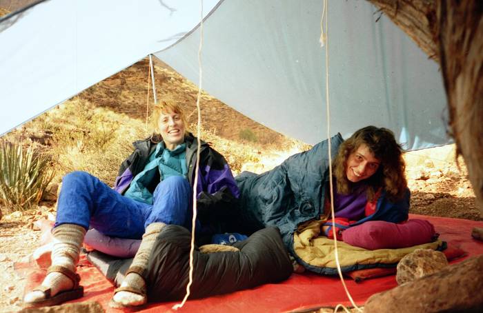
Waiting out the storm
The clouds haven’t done anything all day except make idle threats, but in late afternoon they finally cut loose with a downpour. Unlike last night, we are fully prepared. For a while, sleet is pelting our shelters as we wait out the storm. Soon, though, the precipitation stops, and we crawl out to begin preparing dinner. The clouds still look potent, but that little storm turns out to be the last rain of the trip.
DAY FIVE: Our next stop is Boulder Canyon, another hike of a little over two hours. About half that time is spent getting out of mammoth Grapevine Canyon. We’ve never stayed at Boulder before, and at first glance the place seems less than inviting. Near the only decent camping spots, the creek bed is bone dry. To get water, one must hike upstream for a couple of hundred yards, and even there the stream is only a trickle. Less than enthusiastically, we set up camp.
The more we look around here, though, the more we like it. Hike a few minutes downstream, and the creek re-emerges. Soon it reaches a pouroff of about 30 feet. The pouroff itself is too steep and slick for novice climbers to navigate, but to the left there is an easy way down. At the bottom is a deep, shaded pool. In mid-March it is a delightful little oasis, but by summer it could very well be dry.
On the Tonto east of Boulder
DAY SIX: By now the heat has returned — just in time for our two toughest days of hiking. Today we must go to Lonetree Canyon and load up with water to take to tonight’s destination, Cremation Canyon. Tomorrow we climb up the Kaibab Trail and all the way out of the Grand Canyon.
Loretta is the first to hit the trail. She is setting out alone — something she hates to do, she has told us, because her biggest fear down here is happening upon a snake. Before she goes even 100 feet down the trail, the inevitable happens: “A snake!” she shrieks, frozen in her steps. It’s a footlong rattlesnake. It slithers off harmlessly, but it has made its impact. Loretta decides to wait and hike with the others.
In 90 minutes or so we are at Lonetree. We spend an hour there pumping water through the filter and filling nearly every bottle and bag to the brim. Aptly named Cremation will almost certainly have no water. We need enough to last us the rest of the trip, because the Kaibab, too, is waterless. With our packs at their heaviest yet, we trudge onward to Cremation. The extra weight makes it feel as if someone is trying to pull us down to the ground from behind. The feet and joints take an extra pounding with every step. The sun beats down. This is not fun.
We traverse the three major drainages of Cremation and continue following the Tonto Trail as it climbs to a high spot on the side canyon’s western edge. Beside the trail is huge, distinctive boulder that we call the Flintstone House. This is our destination, finally. Soaked with sweat, we take off our packs. Marlene is curious about something, and instead of resting she strolls down the treeless drainage below us. A few minutes later she returns with the news: There is water down there. Good water — lots of it. Of course. Lugging all those extra pounds was just for the exercise.
This is our last evening down here. Being out near a point instead of tucked into a drainage, we have a sweeping view of the canyon. The sun has dipped below Cremation’s west wall behind us, but its rays are not finished working their magic on the distant cliffs before us. As the minutes pass, buff becomes orange becomes pink becomes scarlet becomes crimson . . . The canyon walls are in constant, fantastic flux. Their texture, too, seems ever-changing as lengthening shadows enhance detail, then swallow it up. We sit and savor without saying much. A bat darts around overhead. Stan rolls each of us a cigarette. Life down here ain’t half bad.
DAY SEVEN: Up and out: That’s the task. Six miles of trail and 3,600 feet of elevation gain, and we’ll be out. We hate to leave the canyon, yet we want to get this climb over with as quickly as possible. Real food and a hot shower sound inviting.
The South Kaibab is wide and well groomed, and the route is direct and efficient. The downside: heavy foot and hoof traffic, including mule trains carrying guests and supplies to and from Phantom Ranch. As we turn off the Tonto Trail and onto the Kaibab, an eight-mule caravan is just ahead, going up. Darn the luck. If we had gotten to the junction two minutes sooner, we wouldn’t be stuck hiking behind the mules, dodging their pungent droppings. Not until Cedar Ridge, just a mile and a half from the rim, do any of us finally pass the mule train.
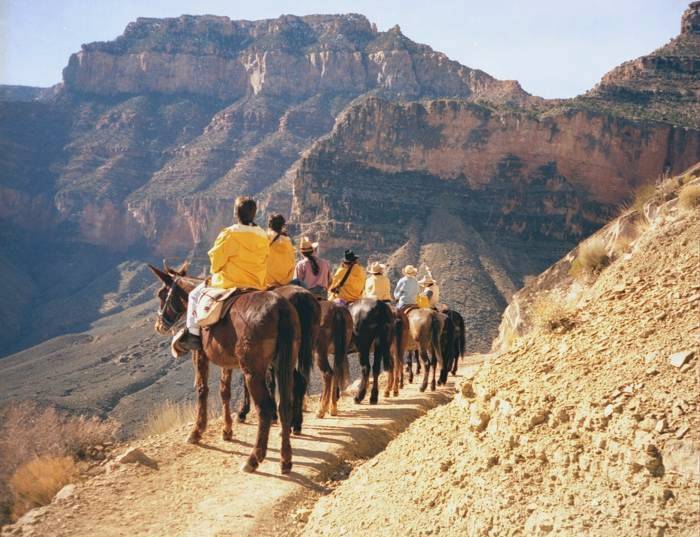
Slow-moving roadblock on the Kaibab
From Cedar Ridge on up, we’re suddenly in tourist territory. Men in polo shirts, women in designer jeans, kids in sneakers. We catch a whiff of cologne here and there — and wonder if these people are catching a whiff of us. “Did you spend the night down there?” a kindly old woman inquires. We must not look or smell as bad as we suspect, or the answer would be obvious.
About three hours after leaving camp, we grunt and groan through the final switchbacks in the white rock of the Kaibab Formation, and suddenly we are out. It’s a Saturday, and the parking lot is packed. Our truck hasn’t been disturbed, and the six beers inside are still cold. This is about all one could ask for. It’s time to celebrate, and to reminisce — and to begin plotting next year’s trip.